Snowshoeing for beginners — 10 tips for tours

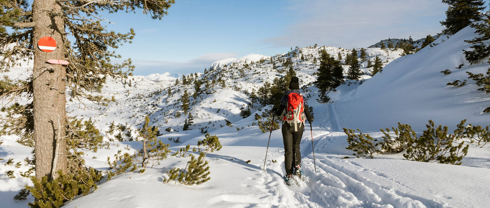
To enjoy the mountains far from the crowded slopes you don’t need to be a ski tour expert or powder snow pro. Snowshoeing is a wonderful outdoor experience for beginners too. Here you will find ten snowshoe hikes for newcomers as well as tips for preparation and planning.
Equipment for snowshoeing
To go snowshoeing, the first thing you need is snowshoes. These can easily be rented for your first attempt at the sport. Two materials are generally available: plastic and aluminium. Cheaper models tend to be made of plastic, but are somewhat heavier than those made of aluminium. The latter give more lift in fresh snow and are better for steep routes uphill. On flat hikes for beginners, the low-priced plastic models will certainly serve the purpose.
Also needed for snowshoeing
- ankle-high and waterproof mountain boots with a firm sole
- gaiters, so that the snow doesn't get into the boots
- various layers of breathable clothes (onion principle) as on a normal winter hike
- adjustable hiking or ski poles, fitted with winter discs
- backpack with sufficient water in a thermos flask plus provisions
- sunglasses and sunscreen
- map of the respective mountain region
- avalanche set if hiking on unmarked trails
First steps on snowshoes
Walking with snowshoes for the first time is an unfamiliar feeling. You can’t walk backwards, for example. To turn round, first turn one snowshoe 180 degrees, then the other. But, once this is mastered, beginners quickly adjust to wearing snowshoes. For the first tour, it's advisable to go with a person who knows the area, or to follow an easy, prepared trail. Other tours can then be planned according to the participants’ physical condition.
Select your snowshoe trail
How difficult a tour is depends on three factors: the length of the trail, how steep the terrain is and how well you can find your way with or without a map. For this reason, the most suitable routes for beginners are those that follow marked routes and are well signposted. However, it should always be noted that fresh snow or fog can make a hike difficult. First attempts should therefore be made on a firm layer of old snow and in good weather. Even for easy hikes, it's generally advisable to check the weather conditions and, at the starting point, visit the tourist information office, for example.
10 snowshoe hikes for beginners
Switzerland is a true paradise for snowshoe hikers and offers a wide selection of tours. Here are ten suggestions for easy yet beautiful snowshoe hikes.
| Snowshoeing | Region | Gradient | Distance | Duration |
|---|---|---|---|---|
| Schwendi lakes | Toggenburg | 135 m uphill and 145 m downhill | 4-5 km | 2 hours |
| Fideriser Heuberge | Graubünden | 245 m uphill and downhill | 4-5 km | 2-3 hours |
| Alp Flix | Graubünden | 400 m uphill and downhill | 6-8 km | 3-4 hours |
| Rigi | Central Switzerland | 315 m uphill and downhill | 6 km | 2 hours |
| Eigenthal | Central Switzerland | 243 m uphill and downhill | 5-6 km | 2.5-3 hours |
| Sparenmoos | Bern | 150 m uphill and downhill | 7 km | 2-3 hours |
| Schwarzwaldalp | Bern | 557 m uphill and 475 m downhill | 8 km | 3 - 4 hours |
| Le Chasseron | Jura | 450 m uphill and downhill | 11 km | 5 hours |
| Riffelberg | Valais | 30 m uphill and 260 m downhill | 3 km | 1.5 - 2 hours |
| Simplon | Valais | 178 m uphill and downhill | 4-5 km | 2 hours |
Hike Schwendi lakes
- Route: Oberdorf – Schwendi lakes
- Region: Toggenburg
- Altitude difference: 135 m uphill and 145 m downhill
- Distance: 4-5 km
- Duration: 2 hours
- Highlight: Circular hike with flat gradient and scenic views
The starting point for this round trip is the Wildhaus Oberdorf chairlift station. From there the hike leads slightly uphill and then over the Freienalp flank down to the Schwendi lakes. These are usually frozen over in winter and can also be skated on. After 40 minutes, turn off at the fork to Hinter Schwendi lake. The tour leads past the Hinter and Vorder Schwendi lakes to the Seegüetli restaurant. From there it goes back to the fork and back again to the starting point at Wildhaus Oberdorf.
Hike Fideriser Heuberge
- Route: Fideriser Heuberge – Arflinafurgga
- Region: Graubünden
- Altitude difference: 245 m uphill and downhill
- Distance: 4-5 km
- Duration: 2-3 hours
- Hightlight: Leisurely half-day tour with beautiful views
This panoramic hike starts at the Arflina mountain inn and leads first to the ski slope. After crossing the slope, it ascends with a gentle gradient to the Arflinafurrga pass. Enjoy the wonderful view from here of Schanfigg and Arosa. After a slight curve the route goes back to the Arflina mountain inn.
Hike Alp Flix
- Route: Sur – Alp Flix
- Region: Graubünden
- Altitude difference: 400 m uphill and downhill
- Distance: 6-8 km
- Duration: 3-4 hours
- Hightlight: Panoramic hike to the high moorland
The starting point is the car park at the church in the small village of Sur on the Julier Pass. From there, the trail follows the prepared Flixer-Strasse to the Son Roc chapel and on to Tigia, where you can stop for a break at the Piz Platta mountain inn. With almost no ascent, the trail now leads to Tgalucas, where Mongolian yurts can be rented in summer. In Courts, the descent to Sur begins, partly following a mountain stream. At point 1779, cross the bridge and continue back down to Sur.
Hike Rigi
- Route: Rigi Burggeist
- Region: Central Switzerland
- Altitude difference: 315 m uphill and downhill
- Distance: 6 km
- Duration: 2 hours
- Hightlight: Beautiful circular tour with restaurant en route
The tour starts at Rigi Burggeist. This can be reached via Goldau with the Kräbel-Rigi Scheidegg cable car. Snowshoes and poles can be rented at the Rigi Burggeist mountain inn. The path is not marked, but is signposted. The circular trail leads via Schneealp to the Scheidegg vantage point and then via the Scheidegg hut back to Rigi Burggeist.
Hike Eigenthal
- Route: Eigenthal – Würzenegg – Chraigütsch – Eigenthal
- Region: Central Switzerland
- Altitude difference: 243 m uphill and downhill
- Distance: 5-6 km
- Duration: 2.5-3 hours
- Hightlight: Leisurely circular tour with ascent to Würzenegg
From the Eigenthalerhof restaurant the trail heads towards Fuchsbühl up to Würzenegg. Enjoy the breathtaking view of the Pilatus mountain range on your ascent. The trail continues to Chraigütsch. From there it already starts its descent along the Rümlig stream. The way back to the Eigenthalerhof restaurant is signposted.
Hike Sparenmoos
- Route: Sparenmoos
- Region: Bern
- Altitude difference: 150 m uphill and downhill
- Distance: 7 km
- Duration: 2-3 hours
- Hightlight: Relaxing circular hike over a sunny high plateau
The start and end point of this scenic circular trail is the car park of the Sparenmoos mountain hotel above the village of Zweisimmen. To start off, the signposted trail is flat and heads in a north-easterly direction to the Site Alp. After the huts at Site Alp, the trail continues over a flat ridge up to Tolmoos. Here at the highest point of the trail, the path crosses the cross-country ski run. Return via Schilteregg, either along or next to the winter hiking trail.
Hike Schwarzwaldalp
- Route: Schwarzwaldalp – Grosse Scheidegg – Schwarzwaldalp
- Region: Bern
- Altitude difference: 557 m uphill and 475 m downhill
- Distance: 8 km
- Duration: 3-4 hours
- Hightlight: Breathtaking backdrop of the Rosenlaui valley
From Schwarzwaldalp, the route follows the pass road through the Schwarzwald forest to Schwandboden and then past the Tannen lake to Grosse Scheidegg. On the ridge, the tour heads along the Chiemattenhubla up to the highest point, the Gratschärem (P. 2006). The descent is via Scheidegg Oberläger (P. 1950) to Bidem. From there, the trail leads back to Schwarzwaldalp.
Hike Le Chasseron
- Route: Les Rasses – Le Chasseron – Les Rasses
- Region: Jura
- Altitude difference: 450 m uphill and downhill
- Distance: 11 km
- Duration: 5 hours
- Hightlight: Scenic ascent with a view of the Jura range
From the starting point at Les Rasses, a marked snowshoe trail leads along the cross-country ski run to Les Cludes. The tour then continues up to the summit of the Chasseron. Here the restaurant and Hôtel du Chasseron offer hospitality and accommodation. On the way back, the tour continues southwest along the ridge to Le Cochet and from there via La Casba back down to Les Rasses.
Hike Riffelberg
- Route: Rotenboden – Riffelberg
- Region: Valais
- Altitude difference: 30 m uphill and 260 m downhill
- Distance: 3 km
- Duration: 1.5-2 hours
- Hightlight: Experience the Gornergrat region on snowshoes
The starting point of this panoramic trail is the Rotenboden station of the Gornergrat railway. The signposted snowshoe trail is marked with pink posts every 100 metres. The tour passes the Riffel lake and offers a spectacular view of the Matterhorn, Obergabelhorn and Weisshorn. After about two hours, you will reach your destination – the Riffelberg station.
Hike Simplon
- Route: Simplon pass
- Region: Valais
- Altitude difference: 178 m uphill and downhill
- Distance: 4-5 km
- Duration: 2 hours
- Hightlight: Ruggedly romantic circular hike at over 2,000 m
This snowshoe tour starts at the car park of the Simplon Hospice or the Monte Leone post bus stop. Pink marker posts indicate the start of the trail. The tour leads over the flatter landscape of the Simplon pass in a northerly direction up to an altitude of 2,100 metres. From there it descends again to the Alpstafel Hopsche and along the Hopschu lake. The route then passes the nine-metre high Simplon Eagle monument before descending to the original starting level.


